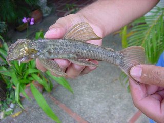
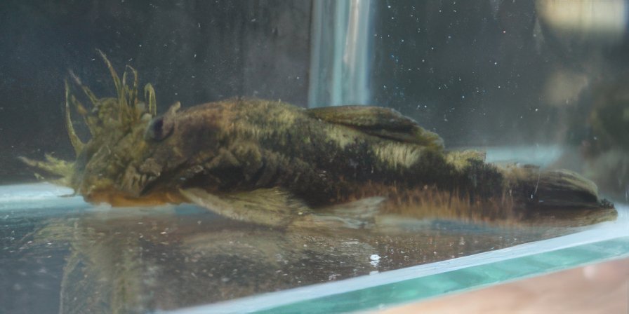
Shane wrote: 06 Jan 2025, 16:30Of interest, this same paper recognizes that there is an undescribed brown Ancistrus from the Rio Chirgua. This sp is in the catelog.
I was a bit surprised to see the 2010 paper considered the brown specimens to be simply a "color morph" of the otherwise gray
rather than setting them aside as a different species, or at least saying they need more study to confirm they're just a color morph of
A. gymnorhyncus.
I was also struggling to understand how the Pao and Chirgua become part of the Orinoco drainage, since they are so close to Valencia. Upon reading the old 1949 paper by Schultz (excerpt below) and looking at websites like Mindat.org and Geohack.toolforge.org, the Schultz paper was in conflict with the websites in that the Schultz paper puts the Pao as a tributary of the Chirgua and the Chirgua leading back to the Rio Portuguesa (and then to Apure and Orinoco), but the Mindat and Geohack websites appear to make the Chirgua a tributary of the Pao, with the Pao reaching down to the Portuguesa. Compounding that, there are two different Rio Chirgua on the maps, both tributaries of the Pao, but one north near the city of Chirgua and the other, probably a much larger river, along the western boundary of the "Area Boscosa Bajo Proteccion Pueblito."
 Viewed 38081 times")
- Overview map of region in Venezuela (from Mindat)
 Viewed 38081 times")
- Inset 1: Blue stars = collection sites of brown A. gymnorhyncus (from Mindat)
 Viewed 38095 times")
- Inset 2: The Pao and the Chirgua reconnect here then diverge again (from Mindat)
 Viewed 38095 times")
- Inset 3: The Chirgua branches off the Pao here (from Mindat)
To compound the confusion, our PCF website had lat/long coordinates for the Chirgua that seemed to be nowhere close to any mapped portion of either of the Rio Chirgua as they appear in satellite images. By the time my head was done spinning, I came to the conclusion that the Chirgua was a tributary of the Pao, and based on the lat/long coordinates provided by Taphorn et al. in 2010, the Ancistrus were collected from a segment of the Chirgua that is near the city of Chirgua (one in an area marked on my figure in red and the other in an area I marked in green - that segment of the Chirgua isn't marked on any of the online maps I viewed, but wrinkly lines on the map following roads or governmental borders would be consistent with a river along there).
But no, it's still not solved. Taphorn et al. wrote that these brown color morphs are found "in the Chirgua River and tributaries (upper Pao River drainage) in Cojedes state." The museum specimen they list is "MCNG 14257, 80, Cojedes, Río Chirgua, between Tinaquillo and Campo Carabobo, 09° 58' 20"N, 68° 12' 40"W, 4 August 1985, D. Taphorn et al." But that set of coordinates is just inside Carabobo State, not Cojedes, although it's close enough that either the map-drawn lines might be off, or the authors were mistaken when the listed the locality as Cojedes
(conversely, the distance from the location to the Cojedes border is about 1km, so that might be considered "margin of error" in the past, although I think by 2010 the standard was higher than that). The other entry they offer from the Chirgua (10° 08' 30"N, 68° 11' 30"W) is clearly in Carabobo state, and they list it as such. The other Chirgua, the more southerly river, is located on the border between Cojedes state and Guarico state.
Shane, when you talk about the undescribed
, do you know which "Chirgua" it's from?
Cheers,
Eric
Here's a textual recounting of the screeen-image I took from Schultz (1949. Proc USNM 99(3235): pp 5-7). The text shows the Pao as a tributary of the Chirgua (I've highlighted them in
bold/blue), and also the footnote states that at one time, it's thought the Pao flowed to the Orinoco. I suppose the discrepancy between Schultz and modern maps might not represent an error on Schultz's part, if it were that the waterways shifted in the last 80 years and now the Pao has a direct connection to the Portuguesa but in the past was connected to the Chirgua. That would resolve one confusion but wouldn't address the issue of the more northern Chirgua in Carabobo State, which is clearly not a tributary of the Portuguesa.
 Viewed 38096 times")
- Image grab from original Schultz paper
Schultz (1949) wrote:A list of drainage basins or stream systems of northern Venezuela is presented below to aid in the interpretation of this report. Each indentation indicates that the body of water is tributary to the one under which it is indented.
- Gulf of Venezuela
- Río Cocuiza
- Río Capatárida
- El Tablazo
- Río Limón
- Lago de Maracaibo 1
- Río Palmar
- Río San Juan
- Río San Ignacio
- Río Apón
- Río Santa Ana
- Rio Catatumbo
- Río Escalante
- Río Chama
- Río Motatán
- Río San Pedro
- Río San Juan
- Río Misoa
- Río Machango
- Caribbean Sen (coastal streams) 2
- Río Tocuyo (Estado de Falcón)
- Río Yaracuy (Estado de Yaracuy)
- Streams near Puerto Cabello (Estados de Carabobo and Aragua)
- Streams near La Guira and Macuto (Distrito Federal)
- Río Tuy (Estado de Miranda)
- Río Unare (Estado de Anzoategui)
- Río Manzanares (Estado de Sucre)
- Golfo de Paria
- Río San Juan
- Río Guanipa
- Orinoco Delta
- Caño Mánamo
- Río Morichal Largo
- Río Uracoa
- Río Orinoco
- Río Coroni
- Río Caura
- Río Suata
- Río Manapire
- Río Apure
- Río Guárico
- Río Portuguesa
- Río Guanare
- Río Chirgua
- Río Cojedes
- Río Uribante
Footnotes:
- All rivers listed in a counterclockwise direction around this lake.
- Listed from west toward the east beginning on the eastern side of the Peninsula de Paraguana, opposite Coro, and continuing to the Gulf of Paria. Lago de Valencia is an enclosed basin at present, but it is listed below under the Orinoco system.
- Lago de Valencia is said to have been much larger at one time and to have had an outlet to the Orinoco system through the Rio Pao.