

https://res.mdpi.com/remotesensing/remo ... tachment=1
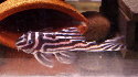
Keywords: Brazil; fractal dimension; neural network; river; rugosity; UAV; underwater; Xingu riverAbstract: Substrate complexity is strongly related to biodiversity in aquatic habitats. We illustrate a
novel framework, based on Structure-from-Motion photogrammetry (SfM) and Multi-View Stereo
(MVS) photogrammetry, to quantify habitat complexity in freshwater ecosystems from Unmanned
Aerial Vehicle (UAV) and underwater photography. We analysed sites in the Xingu river basin, Brazil,
to reconstruct the 3D structure of the substrate and identify and map habitat classes important for
maintaining fish assemblage biodiversity. From the digital models we calculated habitat complexity
metrics including rugosity, slope and 3D fractal dimension. The UAV based SfM-MVS products were
generated at a ground sampling distance (GSD) of 1.20–2.38 cm while the underwater photography
produced a GSD of 1 mm. Our results show how these products provide spatially explicit complexity
metrics, which are more comprehensive than conventional arbitrary cross sections. Shallow neural
network classification of SfM-MVS products of substrate exposed in the dry season resulted in
high accuracies across classes. UAV and underwater SfM-MVS is robust for quantifying freshwater
habitat classes and complexity and should be chosen whenever possible over conventional methods
(e.g., chain-and-tape) because of the repeatability, scalability and multi-dimensional nature of the
products. The SfM-MVS products can be used to identify high priority freshwater sectors for
conservation, species occurrences and diversity studies to provide a broader indication for overall
fish species diversity and provide repeatability for monitoring change over time.
